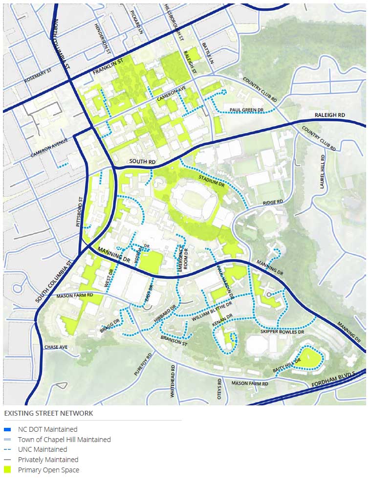
The main campus street network consists of streets owned by the North Carolina Department of Transportation (NCDOT), the Town of Chapel Hill, and the University. NCDOT owns and maintains the major roadways that provide regional access to the campus (NC 54, Fordham Boulevard, South Columbia Street, and Martin Luther King, Jr. Boulevard, South Road, Manning Drive), while the minor streets that provide access to and through the campus are owned by the Town and the University. Many of the intersections on campus are signalized. All of the signalized intersections on campus include amenities for pedestrians and many include detection for bicycles. Nearly all of the streets around campus carry public transit vehicles and bicycles as well as personal vehicles.
The Main Campus has a well-established and robust pedestrian network. Intentional safety improvements to the network have been built since the early 2000s and continue to be built as opportunities arise. Paths connect major activity centers across the campus, with most major routes separated from vehicular traffic. The landscape is well-maintained, providing a pleasant experience that defines the campus. Over time, the University has invested in bridges over major roadways and between buildings to better connect the north and south campuses.
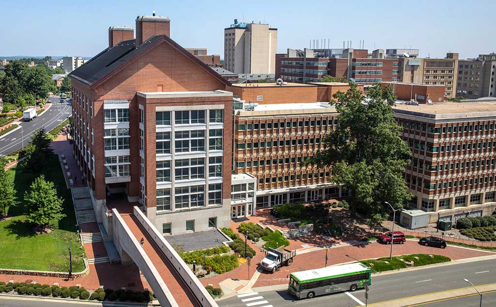
Some locations on campus could benefit from an improved experience. Connections in Campus South can be confusing and the larger building blocks can be intimidating for pedestrians. Manning Drive is seen as a barrier by many; several pedestrian bridges span the road in densely developed areas but all are not well-integrated into the pedestrian network. Similarly, crossing South Road can be challenging at peak times, creating congestion for both pedestrians and drivers. Connections beyond the campus boundary are mixed with the quality of the pedestrian experience decreasing at several campus entrance points where the roads are more suburban in design. However, recent construction for the new Porthole Alley area, which focused on improvement of pedestrian and bicycle safety, demonstrate that there is a commitment to improving these connections. Pedestrian Connection Across Manning Drive
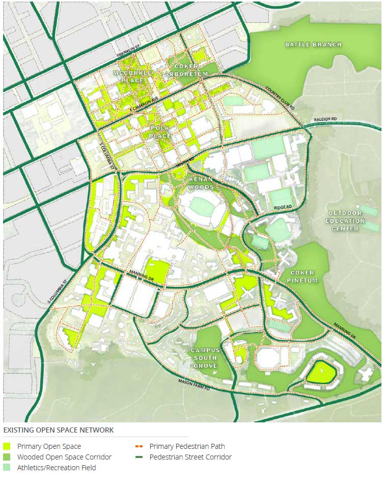
The University’s landscape is irreplaceable and a defining feature of Carolina’s campus and the institution itself. McCorkle Place and Polk Place, the University’s iconic historic open spaces, form the backbone of an intricate network of quads and associated pedestrian pathway networks in Campus North. Refined and revised over numerous periods of campus growth, these quads maintain consistent use of materials and scale on the high point and plateau of Main Campus. Open space of varying character navigates more pronounced topography in Campus South and transitions to larger wooded landscapes that compose the eastern and southern boundaries of the Main Campus. The character of pedestrian connections through Campus South landscapes responds to broader context and topography. Collectively, the University’s diverse network of open space holds both cultural and ecological significance that has persisted through generations of continued stewardship.
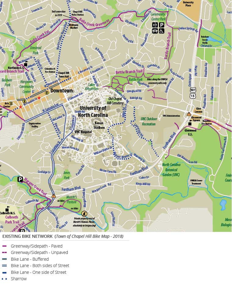
Bicycling has increased in popularity in recent years. In 2014, the University completed their first University Bicycle Master Plan and achieved a Silver Level “Bicycle Friendly University” status. The University implemented the Tar Heel Bikes bikeshare program in 2017 which includes 100 bikes that achieve over three rides per bike per day. Many campus streets have low speed limits, making them generally amenable for use by cyclists. Separated dedicated bicycle paths do not exist on campus, however many bicycle riders utilize internal campus shared use pathways. Painted on road bicycle lanes are located on South Columbia Street south of Medical Drive and Pittsboro Street from Cameron Avenue to South Columbia Street.
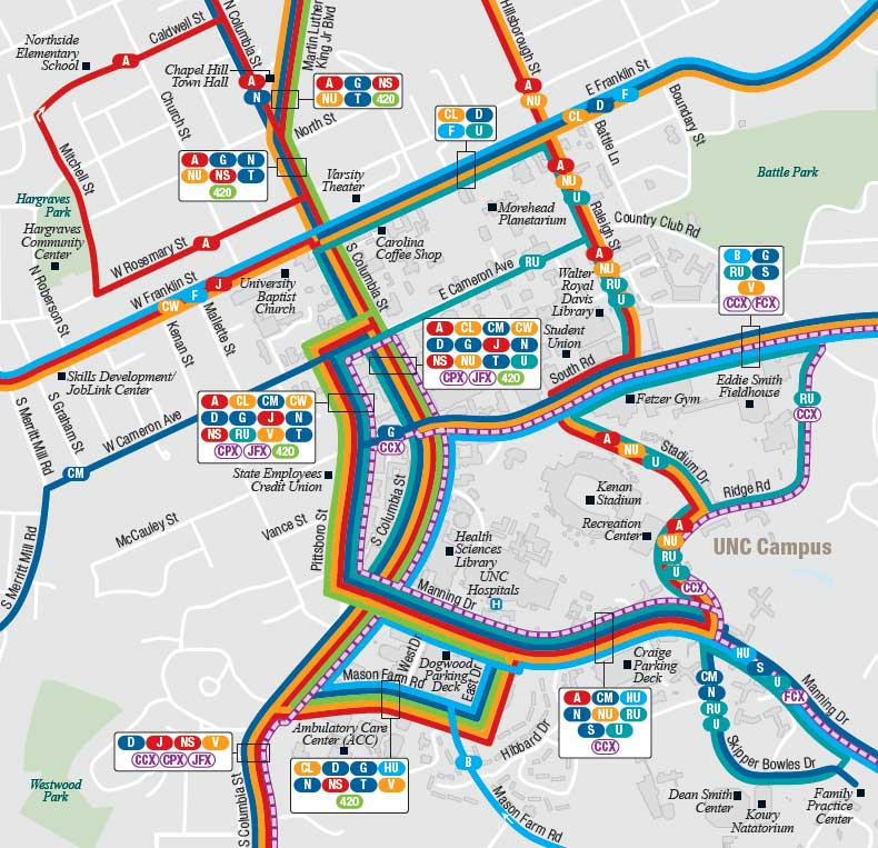
For many students and employees, transit is an integral part of the campus experience. Chapel Hill Transit is fare-free and provides high-quality connections within Chapel Hill and Carrboro in addition to four express routes serving area park and ride locations. GoTriangle operates a number of regional transit routes connecting the campus to the entire Triangle region. The University has included a transit corridor alignment in its master plan since the 2001 plan. This corridor represents a commitment to regional transit and is flexible enough to address future needs. Chapel Hill Transit Map