Outlying Parcels
Environmental Assessment
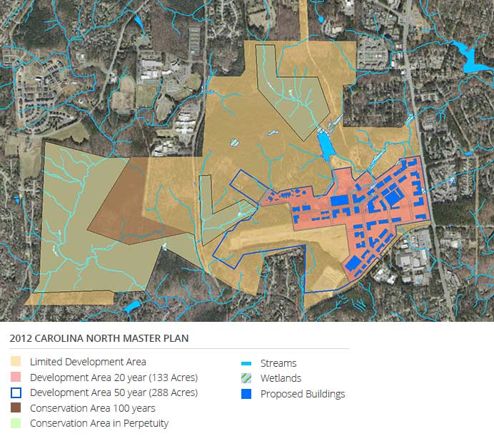
As part of the 2009 20-year Development Agreement with the Town of Chapel Hill, the University agreed to permanently protect 258 acres of the tract in conservation easements, place 53 acres of the tract into the 100-Year Limited Development Area under conservation until 2109, and place 408 acres of the tract into the 50-Year Limited Development Areas under conservation until 2059.
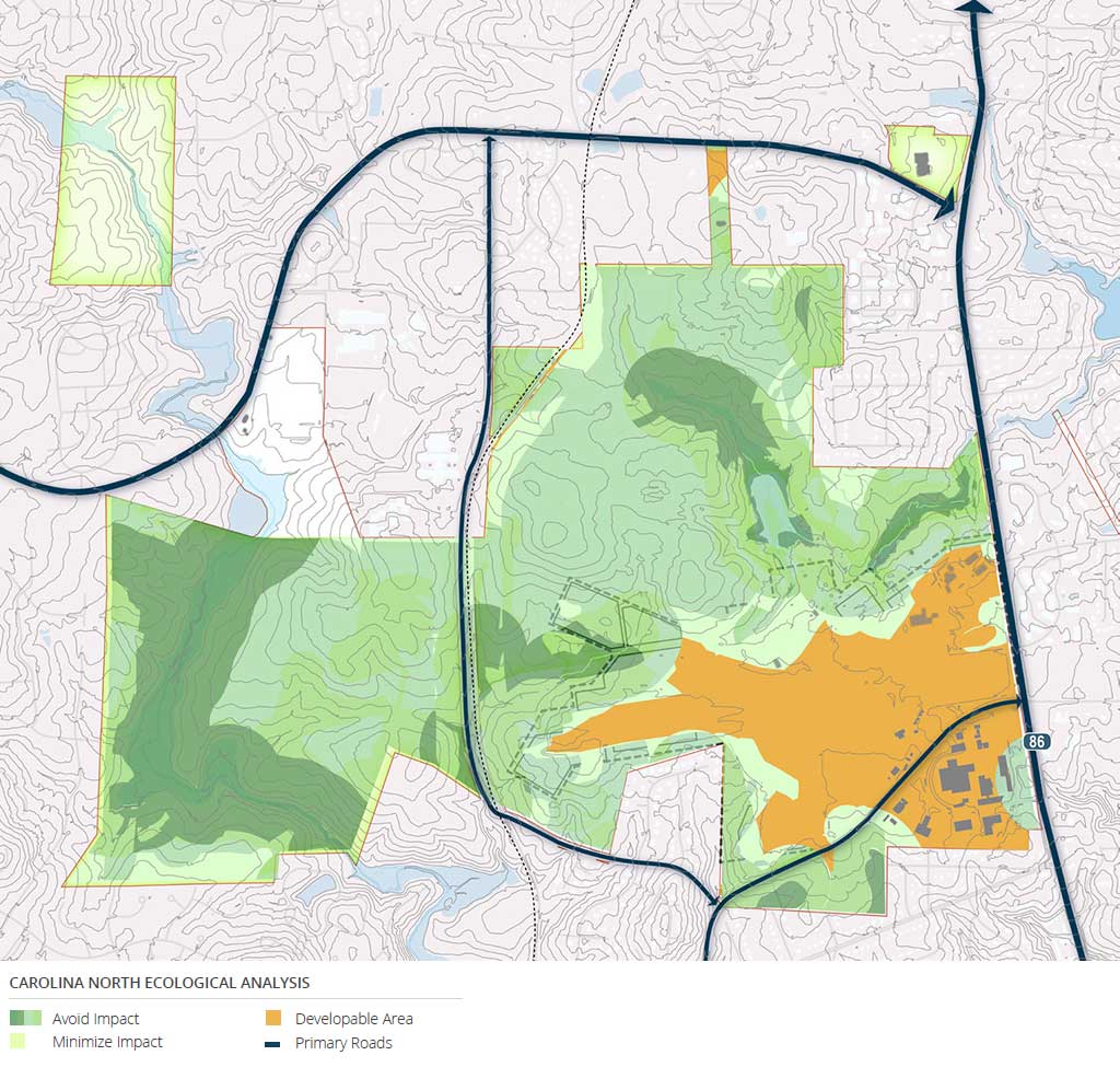
The predominant land cover type in the conservation easement and Protected Areas is forest, composed of a mix of pine and hardwood species. Bolin Creek flows through the western portion of Carolina North. There are wetlands, mostly forested, scattered throughout in low-lying areas and tributaries such as Crow Branch. These important natural resource areas provide a wide range of high value ecological functions. The Development Agreement, the Carolina North Land Stewardship Policy, the Carolina North Master Plan, the Carolina North Stormwater Master Plan, and the Army Corps Individual Permit are documents that provide specific guidance on the management of the natural resources at Carolina North, and ensure that careful consideration toward protection and conservation is given to all development activities at Carolina North in the future.
Transportation
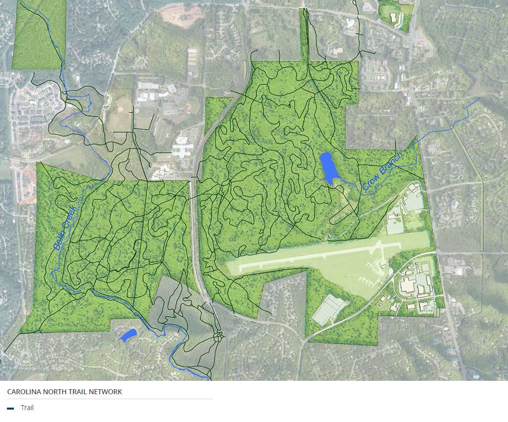
Primary vehicular access to the Carolina North Forest is from Martin Luther King Jr. Boulevard, with secondary access into the former Horace Williams Airport area from Estes Drive Extension. There is a limited interior road network to serve the existing buildings used for various University purposes, and a vast hiking and biking trail system throughout the almost 1000 acre tract. A greenway segment was completed in 2014 to connect Homestead Road with the gravel Pumpkin Loop trail. Eventually this greenway will connect to Town of Chapel Hill trails on the north and south ends of Carolina North.Several transit routes provide service to and from the campus including the NU, which connects the RR parking lot to Main Campus.
Environmental Assessment
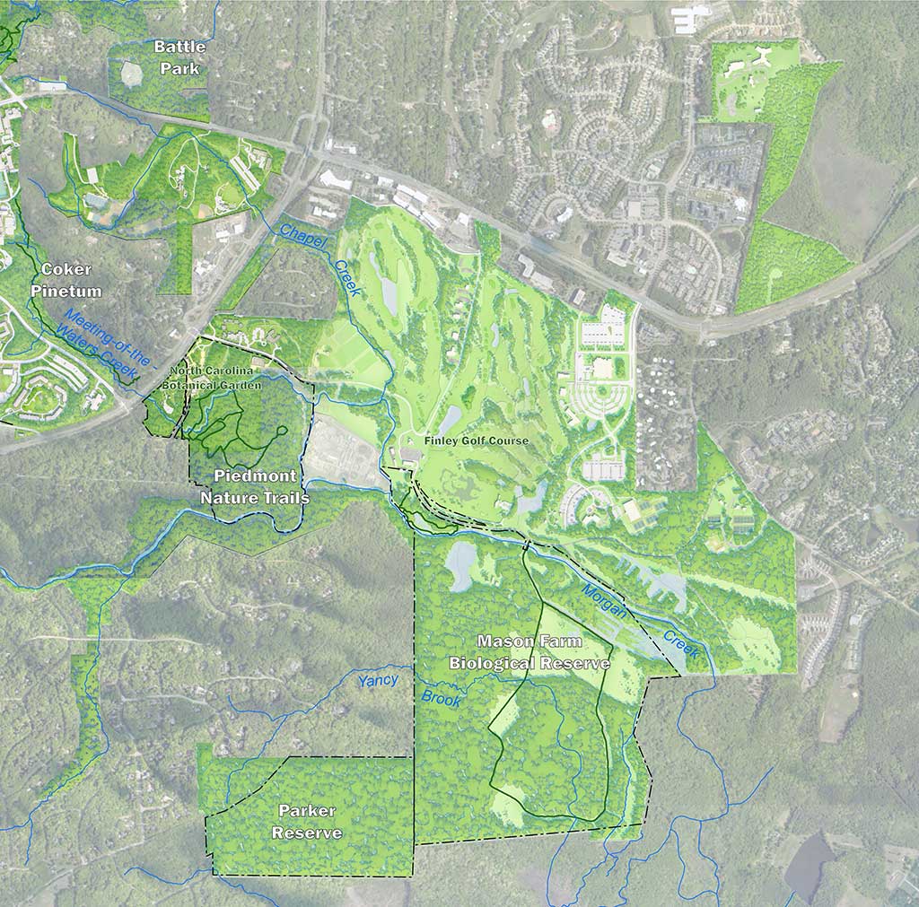
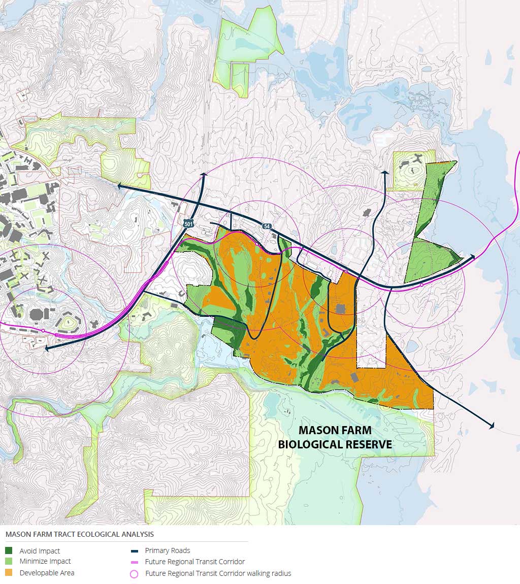
The Mason Farm Tract reflects a wide range of ecological value; from highly developed and built-upon areas such as the Friday Center to cultivated turf-dominated areas such as the athletic fields and golf course, to regionally important and valuable areas of biological diversity conservation areas of the North Carolina Botanical Garden, the Mason Farm Biological Reserve, and the Parker Preserve. About 546 acres have been dedicated for preservation or use by the North Carolina Botanical Garden, including 367 acres at the Mason Farm Biological Reserve. Another 258 acres are used for athletics and recreational activities, including the Finley Golf Course.
Morgan Creek, a prominent water resource for the Chapel Hill area, flows through this property, and its 100-year floodplain is an important feature of the Mason Farm Biological Reserve property from an ecological and development perspective. There are also many smaller tributaries to Morgan Creek that flow through the property, which provide additional aquatic habitat. Wetlands occur on the site, generally in low-lying areas near stream channels. The North Carolina Botanical Garden, Mason Farm Biological Reserve, and the Parker Preserve support hundreds of acres of diverse and mature forest. This area has been identified by the North Carolina Natural Heritage Program as a regionally important natural area, supporting increasingly rare and valuable flora, fauna, and wildlife habitat and the ecosystem services they provide. As such, these areas present important and irreplaceable research opportunities for University faculty, staff, and students.
Transportation
The Mason Farm Tract has several connections to the existing transportation network. The primary connection points are at NC 54, though a secondary access connects to Fordham Boulevard. These access points experience very high vehicle volume today and several are at near-failing levels of service. Internal connections are limited by the golf course, floodplains, and other natural resources. Most roads are narrow and lack pedestrian and bicycle accommodations, but vehicle speeds and volumes are low. A network of trails at the Botanical Garden and trail loops south of Finley Golf Course offer internal access to the area.
The HU and FCX bus routes provide direct transit connections from the Mason Farm Tract to Main Campus. These are supplemented by the S and V routes. Connection to Main Campus on foot or by bicycle is possible, though traffic can make the connection uncomfortable in sections where the route travels adjacent to Fordham Boulevard.